By Kyrmyzy Turebayeva
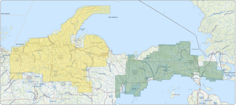
The U.S. Geological Survey has began large-scale low-level airplane flights over Michigan's Upper Peninsula and northern Wisconsin to obtain high-resolution data on subsurface mineral structures and bedrock composition. The data will be used to create two- and three-dimensional maps to better understand the geological structure at depths of about 10,000 feet.
The post Scientists update geological map of northern Wisconsin, Michigan’s Upper Peninsula first appeared on Great Lakes Echo.By Kyrmyzy Turebayeva
The U.S. Geological Survey has began large-scale low-level airplane flights over Michigan's Upper Peninsula and northern Wisconsin to obtain high-resolution data on subsurface mineral structures and bedrock composition. The data will be used to create two- and three-dimensional maps to better understand the geological structure at depths of about 10,000 feet.
The post Scientists update geological map of northern Wisconsin, Michigan’s Upper Peninsula first appeared on Great Lakes Echo.By Eric Freedman
Flashing light on warning signs near curves can slow drivers and reduce the odds of a crash during winter weather conditions, says a new study by Michigan State University engineers.
The post Winter makes curved roads dangerous; researchers seek solutions first appeared on Great Lakes Echo.By Eric Freedman
Flashing light on warning signs near curves can slow drivers and reduce the odds of a crash during winter weather conditions, says a new study by Michigan State University engineers.
The post Winter makes curved roads dangerous; researchers seek solutions first appeared on Great Lakes Echo.