'THE VOICE FOR LAKE HURON'
 
There's Snow Place like Lake Huron
 
Is the Coast Clear? Registration NOW OPEN!
Join us May 12 - 13, 2020 at the Oakwood Resort, Grand Bend for our 11th biennial Lake Huron Conference as we discover and learn from 20+ experts on various coastal topics, local actions and solutions to environmental challenges. This year's theme is, "Lake Huron's Climate: What has Changed?".
 
Speakers include:
 
  • Scott and Acadia Parent, Explorer/Photographer - SUP guide and his daughter Acadia (Read about this inspiring father-daughter duo in the article below!)
  • Lynn Short, Professor in Horticulture/Environmental Stewardship Coordinator, Humber College/Humber Arboretum
  • Greg McClinchey, BA, MPM, Legislative Liaison, Great Lakes Fishery Commission
  • Jenna McGuire, Culture Keeper, Historic Saugeen Métis
  • Todd Howell, Great Lakes Ecologist, Ontario Ministry of Environment, Conservation, and Parks
  • Steve Jackson, Flood and Erosion Safety Services Coordinator, Maitland Valley Conservation Authority
  • Dr. Clare Robinson, Associate Professor, Western University
  • Marcus Maddalena, County Biologist, Huron Stewardship Council/Huron County
  • Lisa Erdle, PhD Candidate, University of Toronto
  • Paul A. Parete, Environment and Climate Change Canada
  • Dr. Frank Seglenieks, Water Resources Engineer, National Hydrological Service of Canada
  • Dr. Andrew Gronewold, Associate Professor, University of Michigan
  • And more! Program schedule and presentation topics to be revealed in the coming weeks. Stay tuned!
 
Don't miss out on early-bird pricing in effect until April 1st. Registration closes May 4th.Tickets are limited.
*Registration rate does not include accommodation.
 
Interested in becoming a Partner? Exhibitors and Silent Auction contributions needed. By supporting this conference you are helping to protect Lake Huron! All of the conference proceeds go towards important programs that help ensure a brighter future for our coastal communities. Please contact us today at 226-421-3029 or coastalcentre@lakehuron.ca.
 
Please visit www.lakehuron.ca/conference for more information.
 
Thank you to our 2020 Partners!
 
Drummond Island to Penetanguishene: A pilgrimage across Lake Huron for microplastics research
 
By: Scott Parent
Last July, my 9 year old daughter Acadia and I set out on a 14’ expedition SUP tandem, from Drummond island Michigan, USA, to paddle along the historic Métis Migration route of 1828 all the way to Penetanguishene, ON, CA. However, our line would deviate from the historic line that followed the North Channel. We would traverse along the South shore of Manitoulin island, in order to travel across all three bodies of lake Huron. North Channel, Lake Huron and Georgian Bay, covering 480km of lake Hurons coastal waters and open water channels.
 
We carried enough gear to support us for one month, as well as camera gear to document our experience, and sampling equipment for our micro-plastics research, including a deep water sampler to collect water samples at depth. We had enough food to last us for up to 12 days at a time, and would resupply along the way, at three rendezvous points. One at Mississagi lighthouse, South Bay Mouth and at Britt. These rendezvous point also allowed us to hand off the precious water samples we had previously collected, while resupplying with new glass containers for the next leg.
 
The Lake Huron Centre for Coastal Conservation was a tremendous aide and support to our cause prior to setting out, providing us with invaluable information on how to collect reliable samples for future testing. We learned the best methods for collecting our samples which would ensure we didn’t contaminate the samples in the collection process.
Our deep water sampler allowed us to collect water samples at controlled depths. We collected samples as deep as 50ft, midway across some historic channels, such as the False Detour Channel between Drummond island and Cockburn island, along the US, Canadian border. As well as the Mississagi Strait, North Channel between Manitoulin island and Killarney, Owen Channel, and the Gap at the mouth of Penetanguishene harbour. These samples proved challenging to collect, with wind and waves threatening our position, as well as the odd time the doors on the sampler would fail to close properly, and we would have to reset it for another grab. It was a laborious and time consuming process. Although the efforts proved invaluable, with the analysis from those samples containing traces of microplastics, confirming their presence beneath the surface.
 
Overall, the journey itself was incredible, and to share this experience with Acadia made it all even more transformative. Athletically driven, Acadia really wanted the personal challenge of paddling the entirety of the route, knowing I would be there to back her up. I recall one day, along the South shore of Manitoulin, Acadia had slept most of the day on the board, while I out paddled 30km from Greene island to Misery Bay. She insisted we paddle out 40km the next day, feeling like she missed out on her contribution to our distance. On average we had to paddle 25km a day, however with wind and waves sometimes holding us back, we often had to cover 30km or more. Our journey took us through some of the most remote waters of the lake. An experience we will never forget.
Here we are a half a year later, and we are going through those samples, analyzing them for micro-plastics. In total we collected 45 samples over a distance of nearly 500km. 5 of those samples were deep water samples.
 
So far we are in the middle of our analysis and we can say-we found micro-plastics. So far all samples we have analyzed have contained micro-plastics, mostly in the form of fibres. The deep water samples that we have analyzed so far have also contained micro-plastics. All of our findings will be summarized in a final report which will be shared with the Coastal Centre, in hopes of furthering our collective understanding of the current state of health of Lake Huron.
 
We hope that our expedition and results of our research help inspire people and organizations in the region, to learn more about the presence of micro-plastics in Lake Huron waters.
 
Ice Cover Update and Ice Safety
 
By: Hannah Cann and Samantha Ventura
Ice Cover Update
Ice cover has been monitored on the Great Lakes since 1973, providing us with a long-term data set of information helping scientists track changes to the health of Lake Huron and predictions for future water levels.
 
Ice cover on the lake acts as a 'lid' holding lake water from evaporating during the winter winds and storms. Evaporation peaks in the fall and early winter when air temperatures drop and water temperatures are still warm. Evaporation off the massive lake surface is increased when cold, dry air blows across warm lake water.
Over the long-term data set of lake ice cover monitoring, we notice a decrease in average annual ice cover from 72% to 58%. This decrease has multiple reasons, with climate change being one of them. When there is less ice cover on the Lake, especially on erodible sections of shoreline, winter storms and wave energy can cause more erosion of the nearshore lake bed and coastal ecosystems adjacent to the shoreline.
As of January 31, 2020, we are sitting at approximately 15% ice concentration. Ice cover typically peaks at the end of February, early March depending on the year. The highest ice cover ever recorded was 98.2% in 1996. More information can be found at https://www.glerl.noaa.gov/data/ice/lakes_AMIC.pdf
 
Follow our ice cover conditions and lake level updates on our website at https://www.lakehuron.ca/lake-level-updates
Ice Safety
There are many factors to consider when thinking about the safety of lake ice. Temperature, thickness, snow cover, water depth, size of water body, currents, and the distribution of the load atop of the ice are all factors affecting ice safety and possible hazards.
 
Here are some general rules to consider before heading out for a day on the ice:
 
  • Know your lake: Have a plan, know your lake access points, local weather patterns and conditions. Local community members or bait shops can provide insight to popular spots, how to access, and the ice conditions.
  • Test the ice: Measure ice thickness in several locations as you travel to your destination.
  • Ice colour: The colour of ice may be an indication of its strength. Clear blue or black ice is the strongest. White or snow ice is half as strong. Grey ice is unsafe.
  • Ice thickness: See Minimum Lake Ice Thickness Guidelines above. Watch LHCCC staff demonstrate how to measure ice thickness here.
  • Take safety equipment with you: Ice spud, flotation suit, throw rope, ice picks, hand and foot warmers, and a cellphone.
 
These general rules are intended to help you stay safe out on the ice and enjoy your time this winter. However, It's important to remember that there is no such thing as 100% safe ice and there is always a risk when you venture onto a frozen body of water. So be prepared, tell your loved ones where you intend to be and have fun!
 
Beat the Winter Blues with Outdoor Activities
 
By: Nicole Cameron and Chantal Lamontagne
 
When the cold weather hits its tempting to join all the other animals in an annual hibernation. But there are actually a number of really awesome outdoor activities that you can do in the winter, and only the winter, along the Lake Huron Coastline.
Hiking and snowshoeing
The biggest difference between hiking and snowshoeing is how much snow is on the ground. Snowshoeing allows for year-round access to many awesome hiking trails, like the trail to the Grotto on the Bruce Peninsula. You can embark on this adventure by yourself, however since these trails are not maintained in the winter you can also book a guide. There are a number of other great trails in the area and gear can be rented at any MEC or often through local businesses. One thing to remember when hiking and snowshoeing in the winter is to stay off groomed cross-country ski trails as footprints reduce the quality of the trail and too much traffic can make trails dangerous for skiers.
 
Skiing
Lake Huron offers a variety of skiing opportunities, from downhill skiing in the blue mountains to cross-country skiing at most parks and conservation areas along the shore. Pinery Provincial park has one of the most impressive trail networks with 38km of ski-able trial. The friends of pinery park offer rentals and trail maps. Make sure to check conditions before heading out.
Ice Fishing
Collingwood is a popular hub for ice fishing on Georgian Bay. But there are a few steps you need to take before heading out. First, make sure to review fishing regulations and that you are properly licensed. Details about licenses and regulations can be found here and information about buying fishing licenses can be found here and here. During most of the year, anyone between the ages of 18-65 who wants to fish needs their own license. However there a few weekends in which no fishing licenses are required for Canadian residents. One of these is family day weekend, Feb 15-17, 2020. Secondly, make sure you have the right gear, most of which can be bought at Canadian Tire or a bait shop. In addition to the standard rod and line, you will need an auger to drill through the ice and a skimmer to remove ice. Once you have all the gear, the last step is to check the ice to ensure it is thick enough to fish on. Here are some more detailed articles on the tips and tricks to ice fishing.
Skating
MacGregor Point Provincial Park has a 400m skating oval and a separate hockey pad that is decked out in lights for you to skate both day and night in some amazing scenery. On family day weekend, The Friends of MacGregor Point Park are hosting a weekend full of fun activities including an evening skate they call “Sparkle in the Park”. Ice reports can be found here.
Winter Camping
A brave choice for how to spend a weekend in the winter is winter camping. Winter camping requires a lot of preparation, and having the appropriate great, to stay safe and have fun. One option is to camp in one of the provincial parks. MacGregor Point, Killarney, and Pinery are available to pitch a tent or trailer and also offer roofed or heated accommodations for overnighting. The other option is the well-kept secret of camping on crown land. Using crown land for recreational activities requires much less formal permitting than camping in a park, but it still has it’s regulations that users need to be aware of. Now the question of what land is crown land? The crown land use policy atlas is a helpful place to start finding your own hidden gems.
 
Other cool activities
Some other ideas for activities in the winter time are snowmobiling (as long as you have the proper permit), birding, fat biking, and dog sledding. Also keep an eye on your local conservation areas and provincial parks for special winter events near you.
 
To fully enjoy all these awesome activities there are a few things you should keep in mind to stay safe and warm:
  • Check the weather frequently. Make sure you double and triple check all water, ice and trail conditions especially in the last couple of hours before leaving. Pay strong attention to any warnings or advisories that might be in effect at the location you’re heading.
  • Layers are your friend. A common phrase among outdoor enthusiasts is “be bold, start cold” in order to prepare for the increase in body temperature once you start moving. The key is to also have a number of layers with varying levels of insulation so you can continuously adjust what you’re wearing to be comfortable no matter how much you are physically exerting yourself. When packing layers make sure you have options for your head, hands and feet as well.
  • Cotton is not your friend. Cotton retains moisture, so after it gets wet from sweat or snow, the cotton won’t dry and you’ll be wearing wet, cold, clothes the whole day. Instead dress in wool or polyester.
  • Have dry clothes ready for you in the car. Weather changes can be fast and dramatic, especially during the winter and if your forced to retreat to your car, having a change of dry clothes that you can put on prevents hypothermia.
  • Bring hot drinks. Having a thermos of tea with you is a great way to warm up while also hydrating. Coffee and hot chocolate do not hydrate the same way but are moral boosters.
 
Upcoming Coastal Community Workshops
 
 
Tues February 25, 2020
6:30 - 9:00 PM
Davidson Centre,
Kincardine
 
 
Wed February 26, 2020
6:30 - 9:00 PM
Bruce County Museum, Southampton
 
Thurs March 5, 2020
6:30 - 8:30 PM
Huron County Museum, Goderich
 
Love your Lake? Save the Date!
 
Mark your calendars because the annual Great Goderich Shoreline Clean-up is coming up on Saturday April 18, 2020.
 
More information to come!
 
The Lake Huron Centre for Coastal Conservation supports environmental efforts along the Canadian coastline of Lake Huron. We foster communication and partnerships between environmental agencies and organizations, working towards a sustainable and resilient coast. We provide education, resources, and information on lake-wide issues and our programs reflect the inter-connectivity between land and water.
 
Follow our social media for updates about our upcoming events and some interesting quick facts about Lake Huron and its coastal ecosystems!
 
The Lake Huron Centre for Coastal Conservation | 76 Courthouse Square, Goderich, ON N7A1M6 Canada www.lakehuron.ca
Unsubscribe doug.dunlop@gmail.com
Update Profile | About Constant Contact
Sent by coastalcentre@lakehuron.ca in collaboration with
Trusted Email from Constant Contact - Try it FREE today.
Try email marketing for free today!

Source


LHCCC 2016 Logo (large) 3
March 2017
 
A Message from our Executive Director 
box_top.gif
Matt at Environmental Defence Gala 4

Wow, do we have a lot to share in this month’s newsletter! The Coastal Centre has been very busy collaborating with environmental groups along our shoreline to protect your lake.

I had the opportunity to attend the Environmental Defense Gala in Toronto. We have had a planning workshop with the Ministry of Natural Resources and Forestry, met with Conservation Authorities, Healthy Lake Huron and the Bruce Peninsula Biosphere Association. We have made presentations to several of your municipal councils, have met with Pine River Watershed Initiative Network and the International Joint Commission.  We are doing all this in an effort to link all environmental groups along our shore to create a cohesive effort to protect and improve the health of Lake Huron.  

In addition to these collaborative activities, we have held three very successful Coastal Community Workshops in Bayfield, Sarnia and Sauble Beach. These sessions were held to collect information from property owners, government and conservation officials and the general public in connection with our Coastal Action Plan. We are making a difference for you! 


Changing Climate and Lake Levels 

As many of us have noticed, this year’s winter has been one of the tamest winters we have had in recent memory. The freeze-thaw extremes experienced over the past month have been unusual to say the least. Weather like this may be optimal for Maple Syrup production, but it is not so “sweet” for our lake and river systems or migratory species.


An example of the change of weather patterns is the recent arrival of the Tundra Swans in the Grand Bend (Wye Marsh) area. Locals say that seeing Tundra Swans this early is very unusual, as they typically don’t come through until early to mid-March. Other residents have voiced concerns about turtles and frogs emerging from hibernation too early during the “thaw” periods, because when “freeze” periods inevitably return they often get hit by cars or fall victim to predators.


2017 will be another year where we wonder where our beach has gone! High water levels will be attributed to heavy precipitation events. The large amount of precipitation expected this month is concerning to some lakeshore and river-adjacent residents due to the inevitable high water levels. Heavy precipitation causes fast water movement across fields, roads and properties resulting in a loss of top soil and erosion, specifically in riverbanks and along shorelines. This fast movement of water, sediment and debris eventually makes its way to our lake and washes up on the beaches of Lake Huron. This debris often includes garbage and litter from roadsides and streets, posing a threat to wildlife and to our water infrastructure. Debris and organic matter become tangled, clogging culverts, drains and river outlets leading to small flooding incidents across roads posing a threat to human safety.  A great way to get involved and reduce the amount of litter filtering into our river and lake would be to do a spring highway or roadside cleanup in your community.


We all love to go exploring outside, and it is important to be aware of children and pets playing around unstable banks and rivers during high water levels. Please take care and be safe this March when enjoying our lakeshore!

box_bottom.gif
A big  thank you to everyone who showed support to our staff and Geoff Peach's family over the past several weeks. We are thrilled to see so much support for the Geoff Peach Coastal Scholarship Fund. This scholarship fund will assist many graduate students pursuing coastal studies around the Great Lakes, and will continue Geoff's legacy. 


Mark Your Calendar!
 
April 1st at 12pm
We are hosting our first shoreline cleanup at the Goderich Beach. Join us under the picnic shelter for a waste-free community BBQ. Help clean the coast and eat some good food!


IMG_8776 2bayfield CAP workshop display table 2
DJI_0022

20160820_103105

Kincardine dunes Aug 2003 -3


20161101_143105 3
Phone:226-421-3029
76 Courthouse Square Goderich ON


If you no longer wish to receive these emails, please reply to this message with "Unsubscribe" in the subject line or simply click on the following link: Unsubscribe

Lake Huron Centre for Coastal Conservation
76 Courthouse Square
Goderich, Ontario N7A 1M6
CA

Read the VerticalResponse marketing policy.

Non-Profits Email Free with VerticalResponse!
 

Source

Member for

12 years 1 month
Submitted by Lake Huron Cen… on

A message from our Executive Director box_top.gif

Welcome, and thank you for taking the opportunity to read our monthly newsletter. This month’s message comes with mixed emotions. For those of you unaware, Geoff Peach, a founder of the Lake Huron Centre for Coastal Conservation passed away recently. Geoff was a strong proponent of coastal environmental preservation and promotion. His ground-breaking work has left a huge footprint on the landscape of Lake Huron. For details about Geoff and to donate to his memorial fund please visit our webpage. 

We are committed to continuing the important work that Geoff started, along with Pat Donnelly. In order to continue this work, we have added a dedicated and experienced member to staff at the Coastal Centre. Hannah LaCroix has accepted the role of Coastal Technologist. The following article has been written by her as her introduction to our readers and the LHCCC. Please join me in welcoming her to our team. 

-Matt Hoy, Executive Director. 

Coastal Wetlands as Natural Infrastructure to Protect Against Extreme Weather Events

February 2nd is the date many of us know to look for Wiarton Willy’s prediction, but it is also World Wetlands Day! This year the theme of, “Wetlands for Disaster Risk Reduction” was selected to bring awareness to the vital role wetlands play in reducing effects of extreme storm events such as floods. With so much interest on the changing water levels of Lake Huron, we at the Coastal Centre think this theme is relevant to our livelihoods and investments along the lakeshore. 

Resilience to extreme events is an issue those that live on the lakeshore think about on a regular basis. Wetlands are called ‘natural infrastructure’ because they reduce stress on water treatment plants and water retention structures ie. dams. Many of us are familiar with wetlands along the lakeshore like those in Oliphant and Port Franks, but fewer of us understand that coastal wetlands occur within 2 km of the Lake Huron coast.  Many wetlands within this 2 km lakeshore zone exist as small swamps dominated by Maple and Ash trees. Although inconspicuous, swamps provide benefits to Lake Huron’s shoreline residents; they filter pollutants, nutrients and sediment from upstream sources, which reduces the amount of algae blooms that occur on the lake. Coastal wetlands prevent flooding by slowing the flow of water during heavy precipitation events and snow melt; and provide wildlife habitat and recreation opportunities including fishing, bird watching, and canoeing. 
You can make a difference by not using all-terrain vehicles within wetlands; keeping the shorelines and water inflows/outflows unhindered and natural; keeping your septic system in good working order to reduce nutrient outflow; and eliminating chemical fertilizer use near wetlands. Visiting public wetlands offers a great family outing, and can be an interesting change of scenery.
There are financial incentives to having a wetland on your property. The Conservation Land Tax Incentive Program allows landowners to qualify for 100% tax exemption for the wetland area. Conservation Authorities and Non-Profit organizations like Ducks Unlimited Canada offer programs to build or expand wetlands at no cost to the landowner. If we work together to invest in natural infrastructure, we all benefit, including the plants and animals that call these areas home.box_bottom.gif

A Coastal Action Plan for Lake Huron

The Coastal Centre is working on the creation of a Coastal Action Plan for Lake Huron, encompassing the shoreline from Sarnia to Tobermory. This is a new initiative intended to join the shoreline together with a common action plan. This plan will enable a coordinated approach to address common issues and goals of communities along the shoreline.

We would like to invite you to attend one of our Coastal Community Workshops, which will allow communities to learn more about the coastal processes that shape Lake Huron, and also share their values, ideas and opinions regarding our lake.

Coastal Community Workshops:

February 07, 2017, 7:00pm, Bayfield Town Hall, Bayfield, Huron County
 
February 23, 2017, 7:00pm, Clearwater Arena, Sarnia, Lambton County
 
February 28, 2017, 7:00pm, Sauble Beach Community Centre, Bruce County

Fill in to win!

If you are interested in providing us with information to shape our Coastal Action Plan, we would appreciate your help by completing our short questionnaire. Visit: http://www.lakehuron.ca/coastal-action-plan-questionnaire

You will be entered for a chance to win a $50 gift card from Mountain Equipment Co-op, or a 1-year subscription to Alternatives Journal!

Member for

12 years 1 month
Submitted by Lake Huron Cen… on

A message from our Executive Director 

Happy New Year from the Lake Huron Centre for Coastal Conservation!I hope you enjoy this month’s edition. It is an educational article describing what happens to your lake during these cold winter months when most of us are enjoying the warmth of our homes.


The Coastal Centre has been busy planning for 2017. Some of the main programs we are planning for are:

  • The Coastal Action Plan   - A comprehensive plan of the waterfront from Sarnia or Tobermory to benefit citizens and government
  • Coast Watchers - A citizen science program where volunteers record data and forward it to us to collate
  • Butt Free Beach - A program to promote the elimination of cigarette butts on our waterfront beaches
  • Shoreline Cleanups - Organizing cleanups with partners to rid our beaches of trash
  • Protecting Species at Risk - Educational program about coastal wetlands, to protect Species at Risk
  • Invasive Species Management - Education on invasive species, and hands-on work to manage invasive species with a particular focus on Phragmites australis
  • Green Ribbon Champion - A shoreline stewardship and education program designed to provide advice, resources, and support to residents along the Lake Huron coastline.

These are our main programs; however, we do considerable work supporting Municipalities along our shoreline, educators and cottage associations.

I would like to thank those of you able to support us financially over the last year. Your donations are what keep our programs running and our doors open.

~ Matt Hoy

Executive Director 
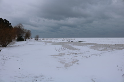
What Happens to Lake Huron in the Winter?


IMG_0621 4

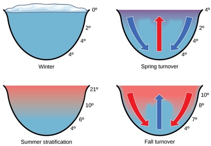
As the seasons turn, so do the Great Lakes. Changes in the temperature profile of a lake is called thermal stratification. As the air temperature cools in the fall, the water at the surface of the lake becomes cooler and more dense. This dense water sinks to the bottom, mixing the lake water and creating a uniform temperature, while replenishing oxygen and nutrients. This movement of water, called “fall overturn” also has implications for the distribution of pollutants.
fall turnover 2

As winter approaches, and the surface temperature of the lake drops down to 4oC the water no longer sinks and the water molecules begin to solidify. As the water temperature reaches 0oC ice begins to form, and ice cover prevents the wind from mixing the water. The water begins to form layers, called “stratification”, which could be compared to a delicious trifle. The lower layer is usually around 4oC and the upper layer, just under the ice, is usually slightly colder, between 0oC and 4oC.

Since Lake Huron is such a large lake, it can hold its summer heat well into winter, and rarely freezes over entirely. As dry arctic air masses blow across the large surface of the lake, the air is able to gain heat and moisture, fuelling snow squalls. With climate change predictions we can expect snowier winters, higher winds, and more frequent storms.

A number of fish and turtle species use our Great Lake’s coastal wetlands as overwintering grounds.  In winter there is less food and oxygen available for Ontario’s fish due to a reduction in aquatic plant activity and availability. Ontario’s turtles hibernate in the bottom of water bodies, below the frost line where they will not freeze, conserving energy and oxygen stores. A turtle’s heart beats only once every 10 minutes in the winter.

In winter American Beach Grass (Marram Grass) goes through a period of dormancy. Many coastal plants enter a rest period at this time, and plant growth slows or halts completely. While the parts of the plant above ground turn brown and are no longer living, the roots are still alive, but less active. Even though the leaves of beach grasses may appear brown in the winter, these plants are still effective in trapping windblown sand and protecting the shoreline against winter storms.
Just because the fish have slowed down doesn't mean we have! When you donate to the Coastal Centre, you are helping us protect Lake Huron for the benefit of us all. 
LHCCC 2016 Logo (large) 2


If you would like to donate to us, please click here.
 

Come visit us at our office on the Goderich Sqaure. Staff are always happy to answer any lake-related questions you may have. 

             staff photo
Our office hours are from Monday to Friday
 8:30 - 4:30
 
You can also call us:
 226-421-3029

Member for

12 years 1 month
Submitted by Lake Huron Cen… on
IMG_2423
Matt Hoy, Executive Director
It has been an exciting first month in my new role as ED for the Coastal Centre! Time is flying by!

During my short time I have had the opportunity to become acquainted with our talented staff and coastal conservation consultants. To say I am impressed would be an understatement. We have some incredibly skilled and dedicated individuals associated with the LHCCC. Although I was impressed with the reputation of the Coasal Centre prior to coming here, I am even more confident in the abilities of our organization, and our ability to provide expertise to Governmental Agencies, Cottage Associations and individuals looking for guidance and support.

I have had the opportunity to meet with many of our corporate partners and board members. This will be a continued focus for me to expand and build upon our current relationships.  In particular, I had an exceptional day with our board member Nancy Vidler, touring the communities within the Port Franks area. I learned so much about the ever present danger to our environment associated with the invasive plant, Phragmites. Thank you Nancy!

A project I have undertaken that I am particularly proud of is organizing a meeting of the minds for Municipalities stretching from our service area of Sarnia to Tobermory. We are already receiving a positive response from Mayors, Councilors and the media. More on this exiting meeting to come in future newsletters, stay tuned.

Thank you for YOUR contribution to the environment and our lake. I look forward to providing you with more updates in the future.
 
Matt

Matthew (Matt) Hoy
Executive Director
Lake Huron Centre for Coastal Conservation


Litter Bugs For The Next Generation

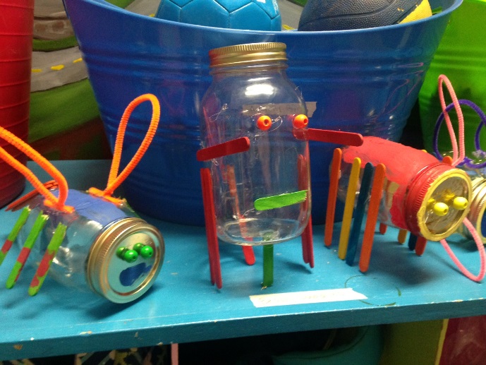
                            Litter bugs 3 
 Image: Litter Bug Craft Making, Bruce County Museum and Cultural Centre (photo R. Moore)
 
In July, Coastal Centre staff visited the Bruce County Museum and Cultural Centre and showed children aged 5-10 how to make their very own “litter bug”. The litter bugs are made of mason jars, wooden beads, and popsicle sticks. Children can take their litter bugs to the beach and fill them with litter. Litter bugs’ favourite foods are plastic bottle caps, food wrappers and small pieces of plastic. HINT: To keep your new pet happy, you should fill it with litter at least once a week and empty it when you get home!


Plastic Pollution in Lake Huron and Beyond — An Overview

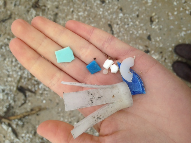
 beach garbage 2 Plastic pollution, which affects both ocean life and freshwater ecosystems including Lake Huron, is becoming a hot topic these days. Plastic ends up in rivers, lakes and oceans through improper waste management, littering, and by way of storm drains and runoff that carries plastic debris into the water.
These plastics are generally everyday items such as Styrofoam cups, plastic bags, and cigarette filters. In fact, 90% of plastic items in our daily lives are used just once and then thrown away. Global plastic consumption reached 300 million tons last year, and continues to rise to meet our demand for single use convenience products. Unfortunately, this convenience is coming at a cost to our coast. Wildlife such as shorebirds, fish, and turtles ingest these pieces of plastic or get entangled in them and are unable to break free. Many types of plastics also absorb pollutants on their surfaces, and when ingested can cause further harm. A recent study which included Lake Huron, found that, on average, there are approximately 43,000 plastic pieces per kilometer squared in our Great Lakes.
 Image: Plastics on Ipperwash Beach, Lake Huron (photo R. Moore)

It may sound gloomy, but many people such as the team at the Coastal Centre remain optimistic that we can turn the tide on plastic pollution. At our Biennial Conference this past May,  Dr. Philippe Van Cappellen discussed the topic in detail, bringing awareness to the issue. Jen Pate, a shoreline resident in Bayfield and owner of Windmill Lake Wakeboard & Eco Park, is helping to lead a Great Lakes wide water sampling and shoreline cleanup event—the biggest simultaneous water sampling in the world to detect microplastics. And everyday people, like me and you, are changing our habits to reduce our plastic footprint. Levels of governments too, are meeting our concerns with positive actions. In July, the Canadian Federal Government classified microbeads as toxic (yay!), an important step towards banning these harmful microplastics altogether. There is hope, and being an active part of the solution will help you see it--we promise!
 

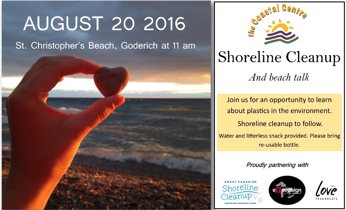
August 20th:  Be Part Of The Solution To Plastic Pollution!

This month, The Coastal Centre is partnering with eXXpedition Great Lakes to take part in the world’s largest simultaneous water sampling. On Saturday, August 20th at 11 am, join us in Goderich at Saint Christopher’s Beach for a free beach talk. The talk will be followed by a shoreline cleanup and water sampling. Samples from across each of the Great Lakes will be sent to a laboratory for testing, and results will be available to the public.
   Shoreline cleanup poster Aug 2016 2


Let’s Keep Those Butts Off The Beaches!

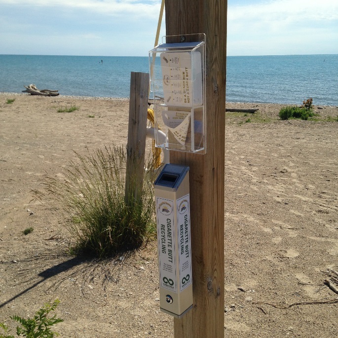
This is the third beach season that the Coastal Centre has implemented our “Butt Free Beach” campaign to raise awareness about the impacts of littered cigarette filters, and help reduce the number of butts on the beach.

butt free beach 2Cigarette filters are the #1 littered item in the world, and unfortunately, Lake Huron’s coast is affected from this discarded waste. Cigarette filters are actually made of a type of plastic, called cellulose acetate that never fully decomposes in the environment. Instead of decomposing, the cigarette filters leach toxic chemicals into the water and break into smaller pieces, which can end up in the stomachs of coastal wildlife such as birds, fish, and turtles.  The Coastal Centre’s Butt Free Beach campaign provides municipalities with educational signage, cigarette recycling bins, and free recyclable beach ashtrays to curb littering habits. All cigarette butts collected through our campaign’s recycling bins are sent to Terracycle to be recycled. We have 15 cigarette recycling bins installed from Sarnia to Sauble Beach.

Image: Free beach ashtrays and cigarette recycling bin (photo R. Moore)


images.jpg
 
With the Olympic games underway, we await the cascade of medals that Canadians will be bringing home.

Like Canadian Olympians, the Great Lakes are the best in the world. Of the five Great Lakes, we think the people of Lake Huron would agree that our lake deserves a gold medal.  Gold medals take a lot of hard work, and the Coastal Centre staff and volunteers work hard in the background.  By making a donation to the Coastal Centre, you can help us Go for the Gold!
  You can make a donation electronically at CanadaHelps.org.

donateNow2b1 2

Member for

12 years 1 month
Submitted by Lake Huron Cen… on

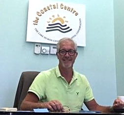
The Coastal Centre Welcomes New Executive Director

The Lake Huron Centre for Coastal Conservation Board of Directors are pleased to announce that Matthew Hoy joined the Coastal Centre team on July 4, 2016 as the new Executive Director.

Matt Hoy

Matthew (Matt) Hoy, Executive Director

Matt is a long term resident of Goderich and is deeply committed to both his community and the Lake Huron shoreline.  Matt has had a successful career within the financial industry, however has decided to change his vocation and focus his efforts to benefit both the Lake Huron coastline and the environment. He firmly believes the strength of communities along Ontario’s southeast shoreline lies in the health of our Great Lake.

The new Executive Director brings to the Coastal Centre, strong financial and governance experience, a municipal government background, facilitation and media relations expertise, and a history of community support and fundraising.   The Board is thrilled to have someone with Matt’s wealth of experience to be joining our organization and we look forward through his leadership to guide the continued growth of the Coastal Centre.

Matt is an elected councilor with the Town of Goderich, past Co-Chair community fundraising as a result of the Goderich Tornado, Past Chair of Alexandra Marine and General Hospital Foundation during the CAT Scan Campaign for Huron County, and has been involved in numerous other key projects.

Matt is looking forward to working with coastal residents, government agencies, other environmental non-profits, and corporate partners to promote the Coastal Centre and the outstanding work it does along the Lake Huron coastline from Sarnia to Tobermory.   Matt also sits on numerous other boards and committees, is the Pipe Major of the Celtic Blue Highlanders Pipe Band, and is the proud father of Abilgale and Alexander Hoy.

Member for

12 years 1 month
Submitted by Lake Huron Cen… on

Mysterious Yellow Scum... Not So Mysterious<

If you went to the beach on June 19, you might have seen this – yellow scum floating on the surface of the lake.  The Coastal Centre has received several inquiries about it, and had some concerned folks send us photographs, which were very helpful.

The timing was a main clue in figuring out what it was. This yellow film is an early summer phenomenon, most visible during the month of June floating in large masses and accumulating along shorelines and beaches of Lake Huron and Georgian Bay.

IMG_20160618_132720459

(Photo of yellow material floating on the lake surface, taken north of Grand Bend.
Yellow pollen from area conifer tress, like Cedar and Pine, can be blown onto the
lake's surface.This often occurs in early summer.)

The scum is conifer tree pollen and can sometimes be mistaken for algae or spilled paint or petroleum.

It isn’t harmful and is not a risk to health.

Pollen from evergreen trees usually appears yellow. Deciduous trees produce a pollen that tends to be sandy brown or gray. The pollen is blown onto water from surrounding woodlands by high winds. It then drifts, trapping floating algae and other aquatic debris. The accumulation of material that reaches the shoreline can be smelly when it decomposes. The pollen eventually decomposes or becomes trapped in the sediment along the shore.

The extent of the pollen on the lake surface this June was quite large (we had reports from Grand Bend to Point Clark, as well as from the shores up toward Tobermory).  Occurrences of pollen are typically more localized, so the large geographic area made us wonder if it was something else. The Centre reported the occurrence to the Ministry of Environment and Climate Change, whose staff were initially concerned it may be a blue-green algae outbreak. Blue-green algae, or cyanobacteria, has become common on Lake Erie, and its toxic properties caused the City of Toledo to shut down its water supply two summers ago.

If there is a concern that such an occurrence on Lake Huron is a cyanobacteria bloom (with risk of toxins), samples may be collected by trained personnel for rapid identification of the blooming algae and toxin analysis.  You can check first with the Coastal Centre, but if you are sure of a blue-green algae outbreak, you can report  to the provSpills Action Centre (1-800-268-6060) who will activate the algae protocol for dealing with such occurrences.

More on Blue-green Algae.  

(Article by Geoff Peach, Coastal Resources Manager)

Waukesha Diversion Decision

In June, a decision was finally made on the  request by the City of Waukesha, Wisconsin to take about 8 million gallons (30 million litres) of water from the Great Lakes, to replace its current water supply. Waukesha is the first jurisdiction outside of the Great Lakes watershed to apply for permission to take Great Lakes water. We covered this topic in our March 2016 edition of E-news.The City was ordered by the U.S. federal government to find a new source of clean water, as the groundwater they were drawing from was polluted with high levels of radium, a naturally occurring substance in that area. While one option was to treat the water to remove the radium, they opted to look to Lake Michigan as their first choice.

The Centre provided comments to the Province of Ontario on the matter, suggesting that Waukesha had viable options for their water supply, other than drawing from the Great Lakes.  While Ontario doesn't have decision-making authority on this matter, it does play an advisory role.

In the end, the Great Lakes States decided to approve the diversion of 8 million gallons per day, but with restrictions.

  • the eight Great Lakes states Governors agreed that Waukesha’s diversion application, as submitted, failed to meet the standards of the Great Lakes Compact; and
  • the Compact Council placed significant conditions on the approval, which appears to have improved the proposal’s compliance with the Compact;
  • 100% of the water diverted from Lake Michigan to Waukesha will be returned to the Great Lakes Basin, resulting in no net loss of water to the lakes as required by the Compact.

Cities like Waukesha that are in a county that straddles the basin divide are eligible to apply for a diversion, but only as a last resort. Far-flung communities with no connection to the Great Lakes watershed are prohibited from even applying for a diversion. While we believe that Waukesha has a reasonable water supply alternative, we understand that the Regional Body and Compact Council saw that issue differently.

More on the diversion issue. 

G2G

The Guelph to Goderich Rail Trail, or G2G, is a 127 km train right of way abandoned in 1988 and currently under re-development as a highly accessible public recreational trail for non-motorized use (walking, hiking, running, cycling, snowshoeing and skiing). G2G is currently raising money through crowd funding to make improvements to this trail to make it fully accessible. You can help out at https://www.tilt.com/tilts/guelph-to-goderich-rail-trail

So Hot

We all know that the sun provides us with much needed Vitamin D. But we also know the importance of moderation. You should never get overheated while at the beach. Here is our 4-step process for sun safety.

  1. After a few minutes of sun on the beach, go up to the cottage and pour a glass of your favourite cold beverage;
  2. Sit down in a nice shaded area on your deck, or under a tree;
  3. Grab your chequebook and make a donation to the Coastal Centre;
  4. Sit back, relax, and know that you are now the coolest person for giving to the cause of Lake Huron conservation.

Member for

12 years 1 month
Submitted by Lake Huron Cen… on

Understanding Rip Currents

Summer is a favourite time to enjoy the lake. But too frequently, summer fun can be jarred by a tragic drowning, likely caused by a Rip Current. The Coastal Centre is helping to promote the month of June as “Rip Current Awareness month.” Getting the word out before the summer solstice  will maybe lead to a tragedy-free summer. 
 
A rip current is a narrow, powerful current of water running perpendicular to the beach, out into the lake. Rip currents occur in a low spot in a sandbar or near a structure such as a pier or jetty and a narrow band of fast moving water heading offshore. People often associate rip currents ­ channel currents that can sweep them from shore ­ with oceans. However, they happen on the Great Lakes as well, and have claimed numerous lives over the years.

rip around Kincardine pier
Diagram showing how oncoming waves can generate currents along the shore,
and then develop a rip current where there is an obstruction,like a pier, groyne or jetty.

 
Rip currents can occur along any coastline where there are breaking waves. Scientific investigations of wave and current interactions have shown that rip currents are likely present on most beaches every day as a component of the complex pattern of nearshore circulation. As waves travel from deep to shallow water, they eventually break near the shoreline. As waves break, they generate currents that flow in offshore (away from the coast) and the alongshore (up and down the beach) directions. Currents flowing away from the coast in river-like channels are called rip currents.
 
rip current illustration - Mich Sea Grant
Diagram showing development of rip current and illustrated 'escape route'.
Source: Michigan Sea Grant

Under most lake conditions thecurrent speeds are relatively slow. However, under certain wave and beach profile conditions the speeds can quickly increase to become dangerous to anyone entering the surf. The strength and speed of a rip current will likely increase as wave height increases. They are most likely to be dangerous during high surf (big wave) conditions.
 
Man-Made Structures
Rip currents may occur at fixed locations such as groynes, jetties, piers, or other man-made structures where water can be funneled out to the lake in a narrow channel. In coastal areas with structures, a rip current may result when currents running parallel to the shore are deflected offshore by the structure. As waves approach the shoreline, they usually break at an angle, generating a longshore current that flows parallel (along) the beach. When the longshore current (moving along the shore) encounters coastal structure (such as a groyne, jetty, or pier) it is deflected in an offshore direction. This offshore-directed flow of water is called a rip current.
 
What to Do
  1. Watch this video
     
  2. If you get caught up in a rip current, it's crucial that you keep your wits about you. Your first instinct may be to swim against the current, back to shallow waters. In most cases, even if you're a strong swimmer, this will only wear you out. The current is too strong to fight head-on.

    Instead, swim sideways, parallel to the beach. This will get you out of the narrow outward current, so you can swim back in with the waves helping you along. If it's too hard to swim sideways while you're being dragged through the water, just wait until the current carries you past the sandbar. The water will be much calmer there, and you can get clear of the rip current before heading back in.

     
  3. Knowing how to deal with rip currents makes for smart swimming. If you see someone in trouble, get help from a lifeguard. If a lifeguard is not available, have someone call 9-1-1. Throw the rip current victim something that floats and yell instructions on how to escape. Remember, many people drown while trying to save someone else from a rip current.
  1. Share this information with family and friends. Let’s put an end to summer tragedies.
(Article by Geoff Peach, Coastal Resources Manager)


In Deep

Water levels continue to climb on Lake Huron. After a low evaporation, high precipitation Fall/Winter/Spring, levels continue on their seasonal rise, with another 5-10 centimetres expected this month. The U.S. Army Corps of Engineers projects an approximate 25 cm. increase over the next six months. This would place levels on Lake Huron about 30 cm. below their record highs experienced in 1985-86.  
 
This may come as a shock to anyone who may have purchased a cottage along the shoreline after 1999. From that year until January 2013, we experienced an extended period of low lake levels. Current levels are more in line with what we experienced in the 1970s, 80s and 90s.
 
Recent climate models suggest that lake levels will continue to shift between highs and lows, within the historical recorded range,  possibly with greater frequency.  So, current levels are not unusual, but they stand in sharp contrast to the last decade and a half of low levels.
 
Check on Water Level Gauges here 


Next to Godliness

June 24 commemorates Saint Jean Baptiste, the patron saint of Poutine.  You can be a saint by donating to the Coastal Centre.  Donate to the Centre and sooth your Tourtiered soul.

Member for

12 years 1 month
Submitted by Lake Huron Cen… on
Coastal Centre Hires an Executive Director

The Coastal Centre has grown since its incorporation as a non-profit in 1998.  The Coastal Centre has gone from managing a few grant projects a year with one full-time contractual Coastal Resource Manager to managing twenty-three projects in 2014-15 and a growing number of full-time and part-time staff members.
 
The hiring of an Executive Director has been a goal of the Board of Directors since 2005, and the current Board embarked upon a recruitment plan in the fall of 2015.  We received an overwhelming response to the job opening and feel fortunate to have had such a strong pool of applicants.
 

DSC_0616.jpegThe Board of Directors are pleased to announce that Matt Meade has been selected to fill the position of Executive Director and will officially join our team on June 8, 2016.  Matt has a Honours BA Geography, Post Graduate GIS, and a Masters in Forestry from University of Toronto.  Matt lives in Port Elgin with his wife and  two young children.

Matt began his career with the Canadian Institute of Forestry (CIF) a non-profit organization, as their Species at Risk Education & Outreach Coordinator, then moved into the position of Forestry Extension Manager, and recently took on the responsibility of the CIF Executive Director.  The Board is confident that Matt's knowledge and experience are a great match for the work, staff, and partners of the Coastal Centre.
 
Please join the Board of Directors and staff in welcoming Matt to our organization.  We look forward to introducing Matt over the next few months.  You can also reach Matt directly via email:  matt.meade@lakehuron.on.ca or by calling the office at 226-421-3029 or drop into our new office at 76 Courthouse Square, Goderich to meet Matt in person.
 

Pamela Scharfe, Chair
Coastal Centre Board of Directors

               lh3c-logo_67x50 2


Successful 9th Biennial Conference
 
On May 27, 2016, the Coastal Centre Board and staff hosted the 9th biennial "Is   the Coast Clear?" conference at the UNIFOR Family Education Centre in Port Elgin.  The theme of the conference was "Coast Watchers - Observing Our Coast and Responding to Challenges", and was an opportunity for 143 people who attended   to learn about current and emerging issues facing our lake, and network with people with an interest in moving toward positive change along the Lake Huron coast. 
 
We were honoured this year to have Ontario's new Environmental Commissioner  Dr. Dianne Saxe deliver the conference keynote address.  The day provided an excellent opportunity to learn from environmental specialists from across the Province who presented on their latest work that will benefit Lake Huron.  Topics included:    Rip Current Science: Managing Risks, Controlling Invasive Phragmites  in Ontario, Beach and Dune Conservation, The Great Lakes Protection Act, Adapting to Extreme Lake Levels, Plastic Pollution and Using GIS to Identify Agricultural Trends in Cropping Practices.
 
The conference was made possible through generous sponsorship from Bruce Power, OPG, Enbridge, Huron County Clean Water Project, Province of Ontario, Saugeen C
onservation, and B. M. Ross and Associates Limited.


    Bruce Power Kevin Kelly2   Dr Dianne Saxe    IMG_0529   IMG_0519
       Bruce Power's Kevin Kelly                  Keynote speaker              Coastal Centre Board Chair      Matt Meade, Executive
      introducing keynote speaker                   Dr. Dianne Saxe                        Pamela Scharfe             Director, Coastal Centre


     IMG_0520.jpeg                      DSC_0616 

                    Conference Delegates                                                                       Dianne Sutter, Matt Meade, Pamela Scharfe
                                                                                                                                                 Coastal Centre

 
    speaker                        IMG_0540 2
      Delegates learn about lake water level study                                                  Delegates networking in the exhibitor area


Member for

12 years 1 month
Submitted by Lake Huron Cen… on


Get Ready for Some Learnin'
 
On Friday, May 27th, the Coastal Centre will be hosting its 9th biennial conference on Lake Huron’s coastal environment. We’ve named this event “Is the Coast Clear?” in order to raise the question of whether or not our communities are making any progress or gaining any clarity in how Lake Huron’s environment is being treated. As the title implies, we’re not out of the woods yet, but many people are involved in addressing the challenges.


The great value of the conference is in providing the opportunity for interested people in the lake community to come together, learn about  issues and actions, and network with one another.  We bring in knowledgeable (and entertaining) experts to share the most current information on issues of importance to Lake Huron. We’ve covered many topics over the years relating to water quality, biodiversity, coastal processes and climate change.


This year’s conference continues the tradition of excellence, with Dr. Diane Saxe, Environmental Commissioner of Ontario, as our keynote speaker.   Diane will be followed by a line-up of great presentations.   If there is one frustration that past delegates have shared with us, it’s that we have so many great talks that they can’t get to all the ones they want to attend. It's gotten to the point where people come in pairs or more, so they can split up and attend as many presentations as possible! That’s okay. That’s the kind of interest ­(and strategic thinking) that we relish.


While we may not be McDonald’s, with “Billions Served,” our conference has attracted more than 1000 delegates over the years. It’s not only quality programming in a beautiful lakeshore setting – you also get treated to a great lunch, lots of opportunties to network and loads of information to take home! Plus, we’re minutes from a walk on the beach, once the conference is over!!


Of course, a quality event like “Is the Coast Clear?” is only possible (and affordable) through generous sponsors. Thanks to our conference sponsor Bruce Power, platinum sponsors Enbridge, Huron Clean Water Project, Ministry of Environment and Climate Change, and Ontario Power Generation, and gold sponsors Saugeen Conservation and B. M. Ross & Associates Limited


Register following the instructions on our conference webpage, or call us at (226) 421-3029.  You can get the Early Bird rate until May 20, so don’t delay!  


(article by Geoff Peach, Coastal Resources Manager)


Up and Away!


Water levels on Lake Huron have continued to climb since last summer. The warm El Nino Fall/Winter/Spring has influenced the rates of evaporation. Since evaporation rates are highest when cold Arctic air masses flow over the lake, the significantly warmer temperatures this season has meant reduced evaporation rates. As well, precipitation has been high over this period, with December getting about 150% of typical precipitation.


Lake levels are currently 30 cm. above where they were at this time last year, and projected to increase an additional 5-10 cm. in May. For people returning to the beach this summer, some beaches may appear narrow due to the higher lake levels. In some areas with natural sand dunes, storms will have caused some erosion, creating dune scarps. On the bright side, all of that eroded sand will provide nice sandy beaches on which to lay a towel.  

Sand beach infront of dune scarp-1

(Photo showing sand beach in front of eroded dune scarp. The eroded dune forms the adjacent fine sand beach. April 2016)


In bluff areas, narrow beaches may be a bit more disconcerting, as the narrower beaches provide less protection from oncoming stormwaves, which can lead to bluff erosion. The importance of bluff vegetation on slopes is extremely important in preventing most erosion conditions, and yet we are still getting reports of people clear-cutting bluff slopes to gain a better view of the lake. We’ve talked about the perils of this practice in past issues.

Dune scarp with 6 ft man for perspective 

(Some dunes have undergone significant erosion this spring.

This 2 metre scarp at Point Clark illustrates the amount of sand that has eroded as part of the normal high lake dune cycle. April 2016)

While the higher lake levels may provide better swimming opportunities (less algae fouling), watch going in to the water as branches and roots that may have been on the beach last year may be underwater and pose a hazard underfoot if stepped on.


New Digs

 
Our office has moved!!  The Coastal Centre is now located at 76 Courthouse Square, right in the heart of downtown Goderich. Drop by this summer and have a visit. We’re right next to an ice cream shop.


That got your attention.

 
Remember Your Mother

 
May is a great month. Flowers blossoming, trees breaking into full leaf, birds chirping and warmer days. We also celebrate Mother’s Day in May. Make sure you remember your mother. She gave you love and nourishment, and all the things you needed to grow. Just like Mother Earth. Mother Earth gives us clean water and food to nourish our bodies, and beaches and nature to nourish our souls.


You can give both mothers the gift of conservation by donating to the Coastal Centre. What a way to honour Mom, and Mom Earth! 

 
To make a donation, click here.


Picture1 2